- Printed on Regular Paper (32lb)
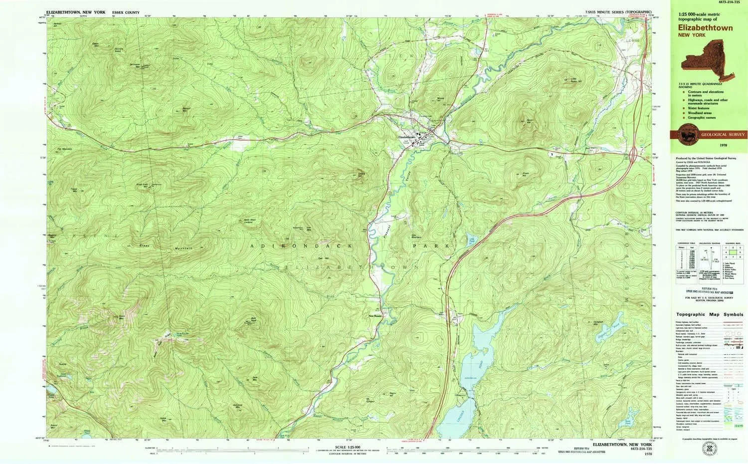
- USGS topographic map of Elizabethtown, NY, at 1:25000 scale. High-quality paper print. Perfect for wall maps.
- Cities, towns, villages: Elizabethtown,New Russia
- Rivers, creeks: Cold Brook,Slide Brook,Brandy Brook,Phelps Brook,Black River,The Branch,Bear Brook,Barton Brook,Beaver Meadow Brook,Roaring Brook,Jackson Brook,Falls Brook,Coughlin Brook,Kerner Brook,Stevens Brook
- Lakes: Nichols Pond,Little Pond,Giant Washbowl,Chapel Pond,North Pond,Marie Louise Pond,Dipper
USGS topographic map of Elizabethtown, New York, dated 1978, updated 1979.
Includes geographic coordinates (latitude and longitude), lines of elevation, bodies of water, roads, and more. This topo quad is suitable for recreational, outdoor uses, office applications, or wall map framing.
Printed on-demand by YellowMaps on the print material of your choice.
Shipping rolled from Minneapolis, MN, United States.
Product Number: USGS-5455073
Map Size: 24.1 inches high x 38.9 inches wide
Map Scale: 1:25000
Map Type: POD USGS Topographic Map
Map Series: HTMC
Map Version: Historical
Cell ID: 75264
Scan ID: 138064
Imprint Year: 1979
Woodland Tint: Yes
Visual Version Number: 1
Aerial Photo Year: 1976
Edit Year: 1978
Field Check Year: 1976
Datum: NAD27
Map Projection: Universal Transverse Mercator
Map published by United States Geological Survey
Map Language: English
Scanner Resolution: 600 dpi
Map Cell Name: Elizabethtown
Grid size: 7.5 X 15 Minute
Date on map: 1978
Geographical region: New York, United States
Northern map edge Latitude: 44.25°
Southern map edge Latitude: 44.125°
Western map edge Longitude: -73.75°
Eastern map edge Longitude: -73.5°
Surrounding map sheets (copy & paste the Product No. in the search bar):
North: USGS-5450499,USGS-5450541,USGS-5450531,USGS-5450497,USGS-5450533
East: USGS-5659270,USGS-5455249,USGS-5455245,USGS-5455247
South: USGS-5455263,USGS-5455265
West: USGS-5455099,USGS-5455097,USGS-5455101


